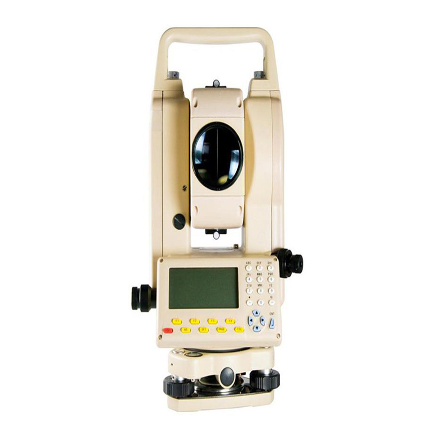
Geographic Surveying Instrument for Topographic Mapping
This precision instrument is used in surveying and mapping applications. It features a high-accuracy angle measurement system and robust construction for field use, providing reliable and accurate data.
Technical Specifications
Product Overview
Professional Topographic Surveying Instrument
This precision-engineered surveying instrument is designed for high-accuracy topographic mapping, construction layout, and geodetic tasks. Featuring an advanced electronic angle measurement system and a clear digital display, it ensures reliable data acquisition in demanding field environments. Its robust construction makes it a dependable tool for professional surveyors requiring consistent performance.
Technical Specifications
Construction
Field-ReadyRobust Design
- Measurement Type
- Angle MeasurementTopographic MappingGeodetic Surveying
- Data Interface
- Electronic digital display readout