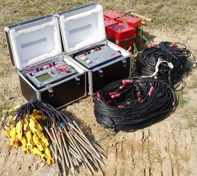
Multi-Electrode Resistivity Survey System
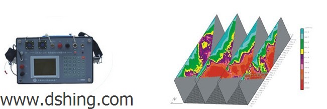
The multi-electrode resistivity survey system measures the electrical resistivity of the ground using multiple electrodes. It provides data for geological mapping, groundwater exploration, mineral prospecting, and environmental studies.
Technical Specifications
Product Overview
Advanced Geophysical Surveying
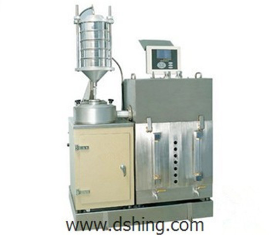
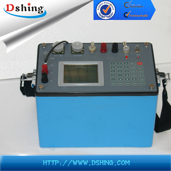
This Multi-Electrode Resistivity Survey System is a comprehensive geophysical instrument engineered for high-resolution subsurface investigation. By integrating data acquisition and multiplexing into a single, compact unit, it minimizes signal errors and enhances field efficiency. It is designed to support critical geological, engineering, and environmental exploration tasks with high precision.
Technical Specifications
- A/D & D/A Resolution
- 16 bit
- Key Measurement Capabilities
- Grounding resistance auto-detectionSP voltage compensationHigh/Low current transformHigh/Low impedance transformation
Applications
Primary Use Cases
- Geological disaster survey (landslides, etc.)
- Engineering exploration (foundations, highways, bridges, railways)
- Mineral and geothermal exploration
- Environmental monitoring and hydrology
- Coal mining and cave detection
Operational Features
Design Advantages
- Integrated data acquisition and multiplexer in one case
- Reduced device volume and weight
- Improved weak signal acquisition capability
- Enhanced data repeatability
- Automated grounding resistance directions