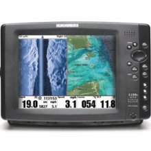
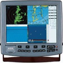
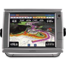
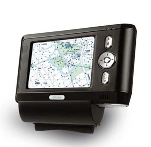
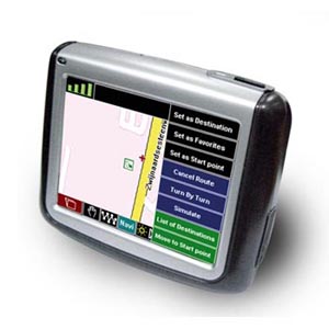
Satellite Receivers
Source high-performance Satellite Receivers from vetted suppliers and manufacturers across Asia. Designed for importers, wholesalers, and telecommunications distributors, our platform connects you with reliable factories capable of large-scale wholesale orders and custom OEM/private-label production.
Sourcing satellite receivers requires navigating a complex matrix of hardware specifications, firmware stability, and regional broadcasting standards. Whether you are procuring basic Free-To-Air (FTA) set-top boxes or advanced hybrid 4K Android receivers with Conditional Access Systems (CAS), the difference between a successful deployment and a high return rate comes down to component selection and rigorous factory-level oversight.
Core Hardware Specifications and Component Selection
The performance of a satellite receiver is primarily dictated by its System on Chip (SoC), tuner sensitivity, and memory allocation. Buyers must specify these components clearly, as manufacturers will often default to lower-tier alternatives to aggressive price targets if left unchecked.
- System on Chip (SoC): The SoC handles decoding, user interface (UI) rendering, and smart features. Common providers include Ali, Sunplus, NationalChip (GX), and Amlogic (for Android-based hybrid boxes). Specifying the exact chipset version ensures your receiver supports the necessary codecs (like H.265/HEVC) and resolutions.
- Tuner and Demodulator: Tuner sensitivity determines how well the receiver locks onto weak satellite signals. Ensure the demodulator fully supports your target market's standards, such as DVB-S2 or the newer DVB-S2X, which offers higher spectral efficiency.
- Memory (RAM and Flash): Insufficient RAM leads to sluggish EPG (Electronic Program Guide) navigation and channel switching. Flash memory size limits firmware capabilities and OTA (Over-The-Air) update headroom.
| Feature Category | Basic FTA Receiver | Hybrid 4K / Smart Receiver |
|---|---|---|
| Typical SoC | Sunplus or GX (Cost-optimized) | Amlogic S905 series or Ali (High-performance) |
| Memory Allocation | 512MB RAM / 4MB Flash | 2GB+ RAM / 16GB+ eMMC Flash |
| Video Decoding | 1080p H.264 | 4K UHD, H.265/HEVC, 10-bit color |
| Connectivity | LNB In, HDMI, CVBS, USB 2.0 | LNB In, HDMI 2.1, Gigabit LAN, Dual-band Wi-Fi |
Need help identifying the right chipset and factory for your target market? Let our sourcing experts guide your technical specifications.
Talk to our teamManufacturing Tolerances and Quality Control
Satellite receivers are notorious for two major failure points: power supply degradation and thermal throttling. Because these units are often left powered on 24/7 in varying climates, the manufacturing process must prioritize thermal management and electrical safety.
When evaluating a manufacturer, it is critical to verify their Surface Mount Technology (SMT) capabilities and their testing protocols. Partnering with a firm that conducts rigorous Quality Control & Inspection directly on the factory floor is the most effective way to prevent defective batches from shipping.
Critical Factory QC Checkpoints
- Tuner Sensitivity Testing: Verifying signal lock capabilities at marginal dBuV levels using specialized broadcast simulators.
- Thermal Stress Testing: Running units at full CPU load (decoding 4K H.265) in a heated chamber to ensure heat sinks are properly seated and SoC temperatures remain stable.
- Power Supply Board (PSU) Validation: Checking capacitor quality and voltage regulation to prevent premature failure under fluctuating grid power.
- Firmware and OTA Verification: Flashing the final production firmware and executing a successful Over-The-Air update cycle before packaging.
OEM/ODM Customization and Firmware Development
For brands and regional distributors, offering a localized user experience is a primary competitive advantage. Engaging in OEM/ODM Services allows you to tailor both the physical hardware and the software layer.
Hardware customization typically involves bespoke casing designs, specialized remote controls (with programmable TV buttons), and custom packaging. On the software side, buyers must negotiate firmware localization. This includes translating the OSD (On-Screen Display), pre-loading regional satellite transponder lists, and designing a branded UI. If you require Conditional Access System (CAS) integration for Pay-TV operators, you must ensure the factory has the licensing and technical capability to integrate systems like Conax, Irdeto, or Verimatrix securely.
Pricing, MOQs, and Lead Times
Pricing in the satellite receiver market is highly volume-dependent and fluctuates with global semiconductor availability. Standardizing your component list helps stabilize costs.
Looking to optimize your bill of materials or negotiate better terms with Asian manufacturers? We manage the entire procurement cycle.
Get a free consultationFrequently Asked Questions
Managing the procurement of satellite receivers requires constant vigilance over component markets, firmware stability, and factory floor execution. By specifying exact hardware requirements and maintaining strict in-line quality controls, importers can secure reliable, high-performing products that defend their brand reputation.
Get Sourcing Help for Satellite Receivers
Tell us your requirements and our experts will connect you with verified manufacturers.