Surveying and Digital Terrain Modeling Software
This software is designed for electronic surveying and digital terrain modeling. It includes tools for coordinate input, measurement, point manipulation, and intersection calculations.
Technical Specifications
Product Overview
Professional Surveying & Modeling Solution
This comprehensive software suite is engineered for precision surveying, digital terrain modeling, and earthwork calculations. It provides a robust interface for handling complex coordinate inputs, point manipulation, and intersection analysis, streamlining the entire mapping workflow. Designed to support high-accuracy electronic surveying, it features intuitive tools for contour generation and structural point editing, making it an essential tool for civil engineering and surveying professionals.
Core Functionality
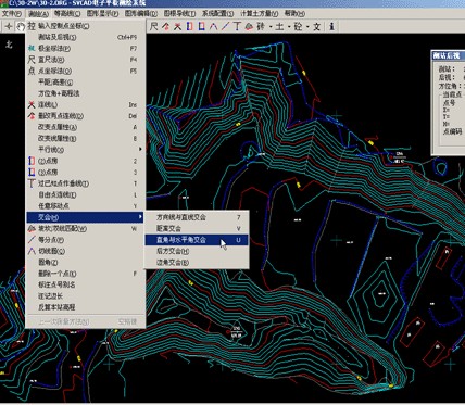
Supported Survey Methods
- Direction line and distance intersection
- Right angle and horizontal angle intersection
- Azimuth and elevation method
- Rear intersection calculation
- Point-to-point coordinate method
- Software Capabilities
- Digital Terrain ModelingEarthwork CalculationCoordinate InputContour GenerationPoint Property EditingData Labeling
System Interface
System Design
Electronic Surveying SupportCAD-Integrated InterfaceReal-time Data Processing