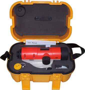
Precision Leveling Instrument for Surveying
This precision leveling instrument is used in geographic surveying to establish horizontal planes and determine elevation differences. It features a bubble level for accurate readings and a tripod mount for stability.
Technical Specifications
Overview
Precision Leveling Instrument
This precision leveling instrument is engineered for high-accuracy geographic surveying, essential for establishing precise horizontal planes and determining elevation differences. Designed with stability and reliability in mind, it features an integrated bubble level for immediate verification of accuracy. It is a versatile tool suitable for demanding applications across construction, civil engineering, and geological exploration projects.
Technical Specifications
Industry Suitability
- Construction
- Civil Engineering
- Geological Exploration
- Primary Application
- Geographic surveying, horizontal plane establishment, elevation measurement
- Key Features
- Bubble LevelTripod MountHigh-Precision Optics
- Mounting Compatibility
- Standard Tripod Mount